Passwort verloren? Neuer Benutzer? Registrieren
Genieße und Trage etwas bei!
| Finde die besten Spots |
|
|
 Peru
Peru
Südamerika
Ort: Western South America, bordering the South Pacific Ocean, between Chile and Ecuador!
Geografische Koordinaten: 10° 0' S, 76° 0' W
Küste km: 2,414 km km
Klima: varies from tropical in east to dry desert in west; temperate to frigid in Andes
Gelände: western coastal plain (costa), high and rugged Andes in center (sierra), eastern lowland jungle of Amazon Basin (selva)
Höhe:
Natürliche Gefahren: earthquakes, tsunamis, flooding, landslides, mild volcanic activity. deforestation (some the result of illegal logging); overgrazing of the slopes of the costa and sierra leading to soil erosion; desertification; air pollution in Lima; pollution of rivers and coastal waters from municipal and mining wastes
Währung: nuevo sol (PEN)
Bevölkerung:
Sprachen: Spanish (official), Quechua (official), Aymara, and a large number of minor Amazonian languages
Hauptstadt:
Bereiche:
Möchtest du Informationen über Peru hinzufügen? Lass es uns wissen ...
Dies ist eine interaktive Karte! Verwende die Steuerelemente zum schwenken und zoomen.
- Kite Sessions (0)
- ausflüge (0)
- Fotos (9)
- Videos (0)
- Teile
- Favorit
-
Deine Favouriten und Zukünftige-Spots-Listen
Spots
| Spots (4) | Qualität | Erfahrung | Typ | Einrichtungen | ||
|---|---|---|---|---|---|---|
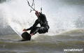
| Lobitos | - / - | Experten | Strand | 

|
||
| Mancora | 3 / - | Jeder | Strand |


|
||
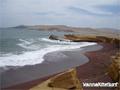
| Paracas | 3 / - | Jeder | Flussmündung |


|
||
| Puerto Morin | 3 / - | Jeder | Strand |
|


 Kommentare
Errors, Feedback
Wenn du neue Information hinzufügen möchtest, oder Fehler in diesem Land gefunden hast, Schicken Sie uns Ihr Feedback.