Mot de passe perdu ?
Nouvel utilisateur ? Créer un compte
Appréciez et contribuez !
| Trouvez les meilleur spots |
|
|
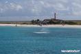
![]() Curaçao
Curaçao
Amérique centrale
Localisation: Caribbean; Part of the Netherlands Antilles.
Coordonnées géographiques: 12° 9' N, 68° 27' W
Côte: km
Climat: tropical; ameliorated by northeast trade winds
Relief: generally hilly, volcanic interiors
Sommets: lowest point: Caribbean Sea 0 m
highest point: Mount Scenery 862 m
Risques naturels: Curacao and Bonaire are south of Caribbean hurricane belt and are rarely threatened; Sint Maarten, Saba, and Sint Eustatius are subject to hurricanes from July to October
Monnaie: Netherlands Antillean guilder (ANG)
Population: 133,644
Langues: Papiamento 65.4% (a Spanish-Portuguese-Dutch-English dialect), English 15.9% (widely spoken), Dutch 7.3% (official), Spanish 6.1%, Creole 1.6%, other 1.9%, unspecified 1.8% (2001 census)
Capitale: Willemstad
Découpage administratif: part of the Kingdom of the Netherlands
Vous voulez ajouter des informations sur Curaçao? Dites-le nous...
Cette carte est interactive ! Utilisez les boutons pour zoomer ou vous déplacer.
- Favoris
-
Vos sites favoris et futures listes de spots
Spots
| Spots (4) | Qualité | Expérience | Type | Facilités | ||
|---|---|---|---|---|---|---|
| Small Curacao or Klein Curacao | 2 / - | Confirmés | Océan | 

|
||
| St Joris Baai | - / - | Débutants | Lac | 
|
||
| st joris baai, curacao | - / - | Débutants | Lac | 
|
||
| St. Jorisbaai | - / - | Intermédiaire | Lagon |
|

 Commentaires
Soyez le(la) premier(e) à commenter ce pays
Erreurs, Réactions
Si vous voulez ajouter de nouvelles informations ou si vous avez trouvé des erreurs sur cette page, Dite-le nous.