Lost password? New user? Register
Enjoy and contribute!
| Find the best spots |
|
|
 China
China
Asia
Location: Eastern Asia, bordering the East China Sea, Korea Bay, Yellow Sea, and South China Sea, between North Korea and Vietnam
Geographic coordinates: 35° 0' N, 105° 0' E
Coastline km: 14,500 km km
Climate: extremely diverse; tropical in south to subarctic in north
Terrain: mostly mountains, high plateaus, deserts in west; plains, deltas, and hills in east
Elevation: lowest point: Turpan Pendi -154 m
highest point: Mount Everest 8,850 m
Natural hazards: frequent typhoons (about five per year along southern and eastern coasts); damaging floods; tsunamis; earthquakes; droughts; land subsidence
Currency: yuan (CNY)
Population: 1,306,313,812 (July 2005 est.)
Languages: Standard Chinese or Mandarin (Putonghua, based on the Beijing dialect), Yue (Cantonese), Wu (Shanghaiese), Minbei (Fuzhou), Minnan (Hokkien-Taiwanese), Xiang, Gan, Hakka dialects, minority languages (see Ethnic groups entry)
Capital: Beijing
Divisions: 23 provinces (sheng, singular and plural), 5 autonomous regions (zizhiqu, singular and plural), and 4 municipalities (shi, singular and plural)
: provinces: Anhui, Fujian, Gansu, Guangdong, Guizhou, Hainan, Hebei, Heilongjiang, Henan, Hubei, Hunan, Jiangsu, Jiangxi, Jilin, Liaoning, Qinghai, Shaanxi, Shandong, Shanxi, Sichuan, Yunnan, Zhejiang
: autonomous regions: Guangxi, Nei Mongol, Ningxia, Xinjiang, Xizang (Tibet)
: municipalities: Beijing, Chongqing, Shanghai, Tianjin
note: China considers Taiwan its 23rd province; see separate entries for the special administrative regions of Hong Kong and Macau
Wanna add some info about China? Let us know...
This is an interactive map! Use controls to pan and zoom this map.
- kite sessions (0)
- trips (0)
- Photos (7)
- Videos (0)
- Share
- Favourite
-
Your favourites and future spot lists
Spots
| Spots (2) | Quality | Experience | Type | Amenities | ||
|---|---|---|---|---|---|---|
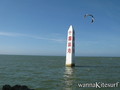
| Donfang | - / - | Everyone | Beach | 
|
||
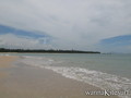
| Wenchang | 7 / - | Everyone | Lagoon |
|


 Comments
Errors, Feedback
If you want to add new information or you have found errors on this country, Send us feedback.